|


| |
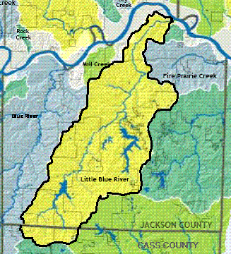
Where is the Little Blue River located?
The Little Blue River is a stream that begins in southern Jackson
County, Missouri, near the town of Grandview, and empties into the
Missouri River just west of the town of Sibley.
Despite its name, it is not a tributary of the nearby Blue River,
nor should it be confused with the Little Blue River of central
Kansas.
 Watershed Map outline
What's in a Name?
The first
names given to the Little Blue River by European trappers and
traders were 'Hay Cabin Creek', 'Cabin Grass
Creek', and 'Straw Hill River'. These early names
were apparently applied because of the arbor-like grass lodges
constructed along the banks by native Americans or, perhaps, others.
William Clark, John Ordway, and John Whitehouse all mention this
stream in the journals they kept during their famous expedition in
1804.
Descriptions recorded in the first General Land Office Surveys in
1826 show a large tract of native prairie near the mouth of the
Little Blue River that may
have been the likely source of material and location of these grass
cabins. Native prairie grasses in this area usually included Big
Bluestem, Indian Grass, Switch Grass, or Prairie Cordgrass. These
grasses can easily achieve 6 to 7 feet of height and would have been
especially thick and tall in the moist and fertile river bottoms
along the stream near the Missouri River.
'Hay Cabin Creek' must have been still in use as late as 1839 when
Joseph Nicollet recorded both this name and 'Little Blue River' on his maps of the Missouri River.
References:
--Moulton, G. E. 1986. The Journals of
the Lewis and Clark Expedition, Volume 2. University of Nebraska Press. 612
p.
--Wood, R.E. Ed., Joseph N. Niccollet’s Manuscript Maps of the Missouri
River and Upper Mississippi river Basin. Illinois State Museum Scientific
Papers, Vol 24. 96 p.
Battle of Little Blue River, American Civil War
The Battle of Little Blue
River was a battle of the American Civil War, occurring on October 21, 1864
in Jackson County, Missouri during Price's Raid.
Maj. Gen. Sterling
Price’s march along the Missouri River was slow, providing the Union Army a
chance to concentrate. Maj. Gen. William S. Rosecrans, commanding the
Department of the Missouri, proposed a pincer movement to trap Price and his
army, but he was unable to communicate with Maj. Gen. Samuel R. Curtis,
commander of the Department of Kansas, to formalize the plan. Curtis was
having problems because many of his troops were Kansas militia (under George
Dietzler) and they refused to enter Missouri, but a force of about 2,000 men
under the command of Maj. Gen. James G. Blunt did set out for Lexington. He
met the Confederate troops at Lexington on October 19 and slowed their
progress, but was defeated and retreated. The next day, Blunt’s troops
arrived on the Little Blue River, eight miles east of Independence.
The Union force prepared
to engage the Confederates again in a strong defensive position on the west
bank. Curtis, however, ordered Blunt into Independence while leaving a small
force, under Col. Thomas Moonlight, on the Little Blue. The next day, Curtis
ordered Blunt to take all of the volunteers and return to the Little Blue.
As he neared the stream, he discovered that Moonlight’s small force had
burned the bridge as ordered, engaged the enemy, and retreated away from the
strong defensive position occupied the day before, crossing the river. Blunt
entered the fray and attempted to drive the enemy back beyond the defensive
position that he wished to reoccupy. The Union troops forced the
Confederates to fall back, at first, but their numerical superiority took
its toll in the five-hour battle. The Federals retreated to Independence and
went into camp there after dark. Once again, the Confederates had been
slowed and more Union reinforcements were arriving.
Source
U.S. National Park Service CWSAC Battle Summary
Retrieved from "http://en.wikipedia.org/wiki/Battle_of_Little_Blue_River"
| |
USGS Real Time Water
Data for LBR

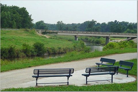
Little Blue River
Photos
|